Author: Sonya Doubledee
Editor: Victoria Maza
“Attempting to delete the data is an explicit attempt to erase the most recent scientific data on environmental health outcomes and suppress public understanding of how manufacturing and production put human health at risk.” – Anonymous
As of early February, the Environmental Protection Agency’s (EPA) EJScreen Tool (Environmental Justice Mapping and Screening), has been removed from the government agency’s website after an executive order (EO) eliminated federal ‘environmental justice’ initiatives. The EPA tool included thousands of datasets, recording greenhouse gas emissions, proximity to hazardous waste, water pollution, and air pollution, alongside racial makeup, income level, and health makeup.
Professors urged students to download EJScreen’s data while it was available, with fears of the widely used database becoming another EO casualty. Classes such as Environmental Justice 285 included assignments centered on the interactive mapping tool and its ability to overlay health and hazard data.
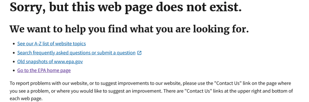
Screenshot taken by the author on February 25th. The only remnants of the EJScreen Tool as it existed on the EPA website is a saved archive of the 2017 website.

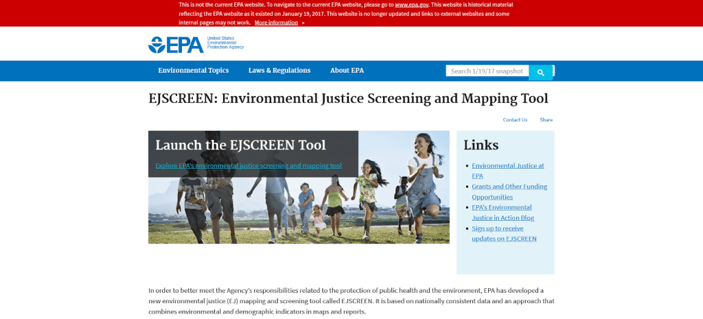
Screenshot taken by the author on February 25th. The 2017 snapshot of the EPA’s website displays the previous homepage of EJScreen.
The removal presents previously unforeseen challenges to undergraduate research. EJScreen was a vital asset to scientists and the general public, providing spatial evidence for environmental risk and exacerbation along racial lines.
While the interactive map is long gone, the underlying data still exists. To combat the screening tool’s shutdown, Harvard Dataverse released EJScreen’s underlying data as a 4.6 GB zip folder. Those who wish to use the map as evidence will have the daunting task of downloading hundreds of datasets and spatially recreating the data.
One post on X, formerly Twitter, from the University of California San-Francisco’s Program on Reproductive Health and the Environment shared an article from the Hill: “Buried in this article is that the new administration has removed EJScreen – the data and tool scientists use to assess how people are impacted by harmful chemicals. But removing the data will not keep people from being exposed.”
The only remnants of EJScreen’s old map interface are former research papers and university web pages promoting the resource. A 2021 article from the University of Maryland details a class visit from Matthew Lee, an Environmental Protection Specialist within the EPA, who encouraged students to utilize the program.

EJScreen’s removal will send a shock wave through conservation and government-based programs. The addition of new climate and hazard layers was the bread-and-butter of the EJScreening tool. Researchers regularly utilized EJScreen, creating new map layers with fresh data that was publicly accessed and simplified. Those data layers have since been taken down.
EJScreen data represented vital public access far beyond the tool itself. Various environmental and conservation programs utilized the spatial data to better understand their own challenges. For instance, The Chesapeake Bay Watershed Program, a regional partnership in the area to preserve ecosystem health, has been working with EJScreen since 2015 to map potential sources of contamination. By overlaying multiple datasets, John Wolf, the GIS team leader for the program, tracked the prevalence of contaminants alongside sites of Chesapeake Bay degradation. He also attended the class meeting visited by Lee at the University of Maryland.

Screenshot taken by the author on February 24th. While the fact sheet appears to exist through a Google search, the PDF is currently inaccessible.
Screenshot taken by the author on February 24th reveals an error message after clicking on an EJScreen fact sheet. Though Google still reveals a summary of the PDF, any evidence of EJScreen is long gone.
Currently, none of the maps available for public access include EJScreen data, including any spatial copies found on ARCGIS online. The existence of any EJScreen utilization in these programs only exists in the dead links of previous blog posts, visualization guides, and university news.
Students in Emory’s Environmental Science Department are devastated.
“EJScreen [was] an indispensable resource for students. It was one of the only accessible ways to view complex EPA data through a simple visual metric. Attempting to delete the data is an explicit attempt to erase the most recent scientific data on environmental health outcomes and suppress public understanding of how manufacturing and production put human health at risk.” – Anonymous
“I think it’s important to know what needs need to be met where and that goes beyond just environmental pollutants but also how we approach financial and community resilience, so EJScreen was very important.” – Anonymous
“I really liked EJ screen and felt like it provided some critical insight in my Environmental Justice class and in my life when I was curious about different environmental effects and how they impact various communities. I was hoping to use it for my honors thesis next year, but will likely reframe to use more accessible resources.” – Anonymous

Leave a comment